Studium Systemu Tras Rowerowych
Study of the Bike Route System
Całe opracowanie dostępne jest pod tym
adresem
The whole study is available
here
Plansze dla GZM
Lokalizacja punktów wykonania foto-inwentaryzacji w terenie na tle wstępnego projektu MSTR
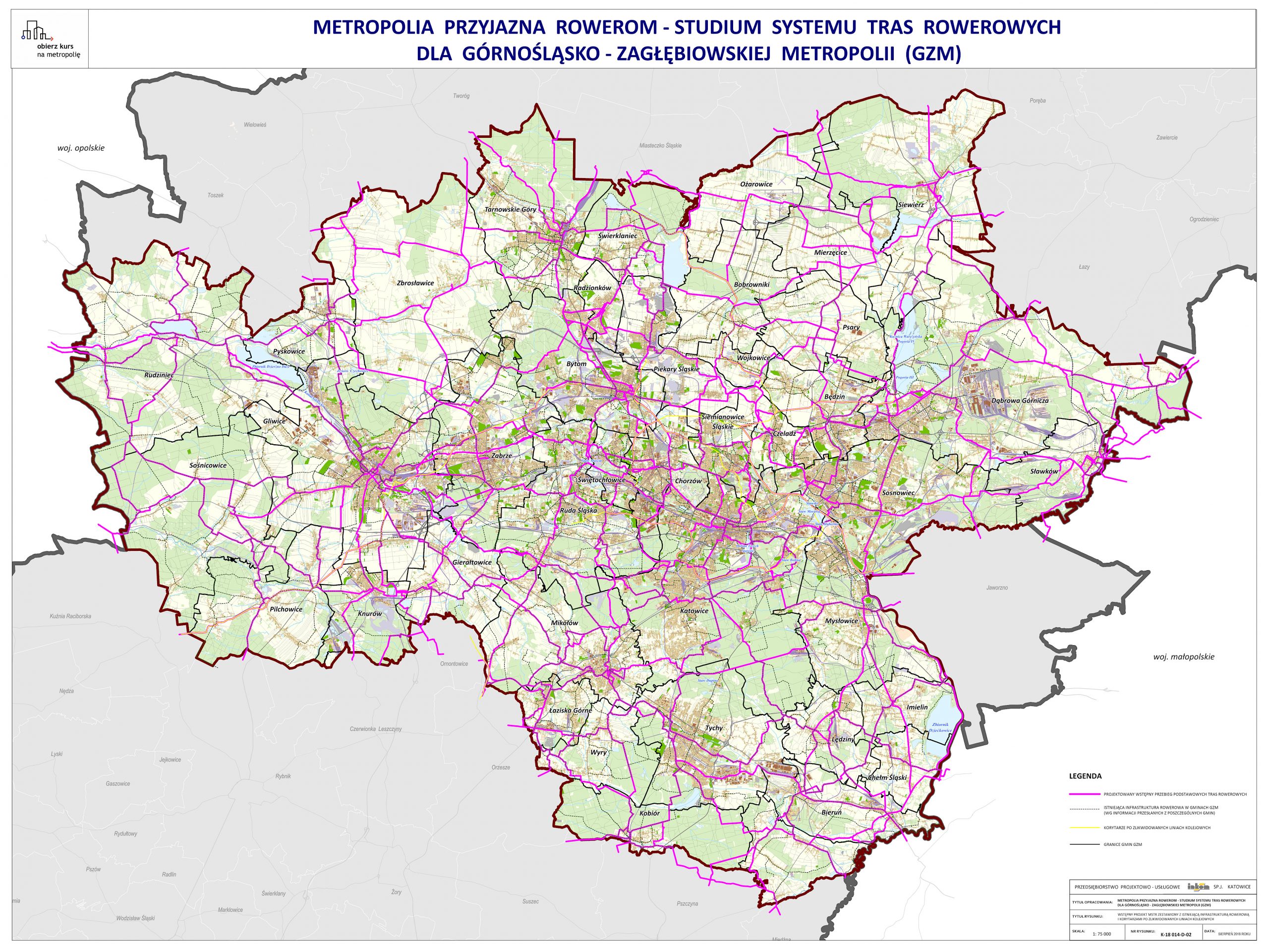
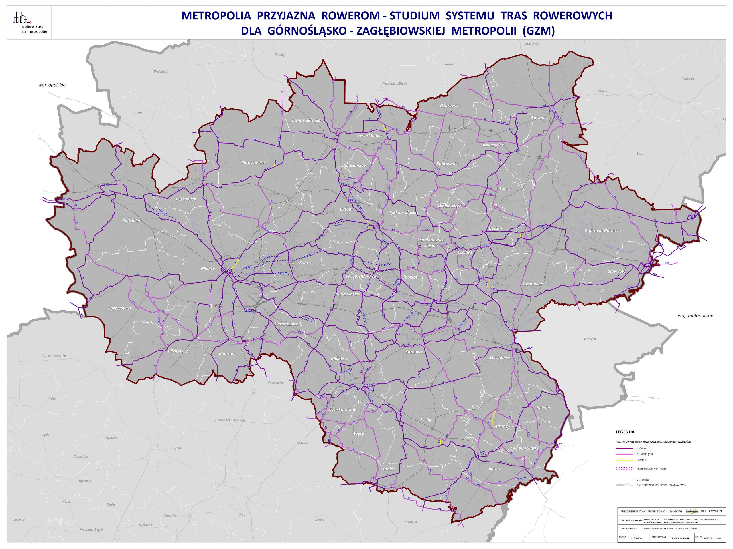
Wstępny projekt MSTR zestawiony z istniejącą infrastrukturą rowerową i korytarzami po zlikwidowanych liniach kolejowych
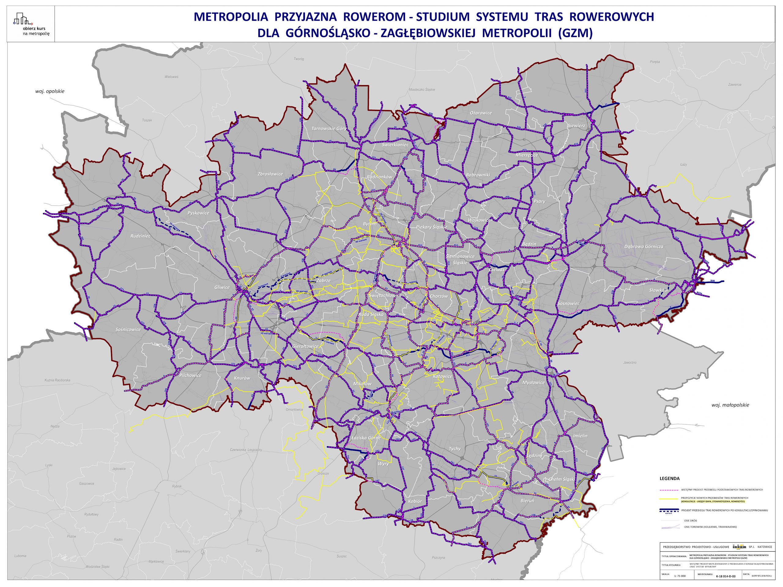
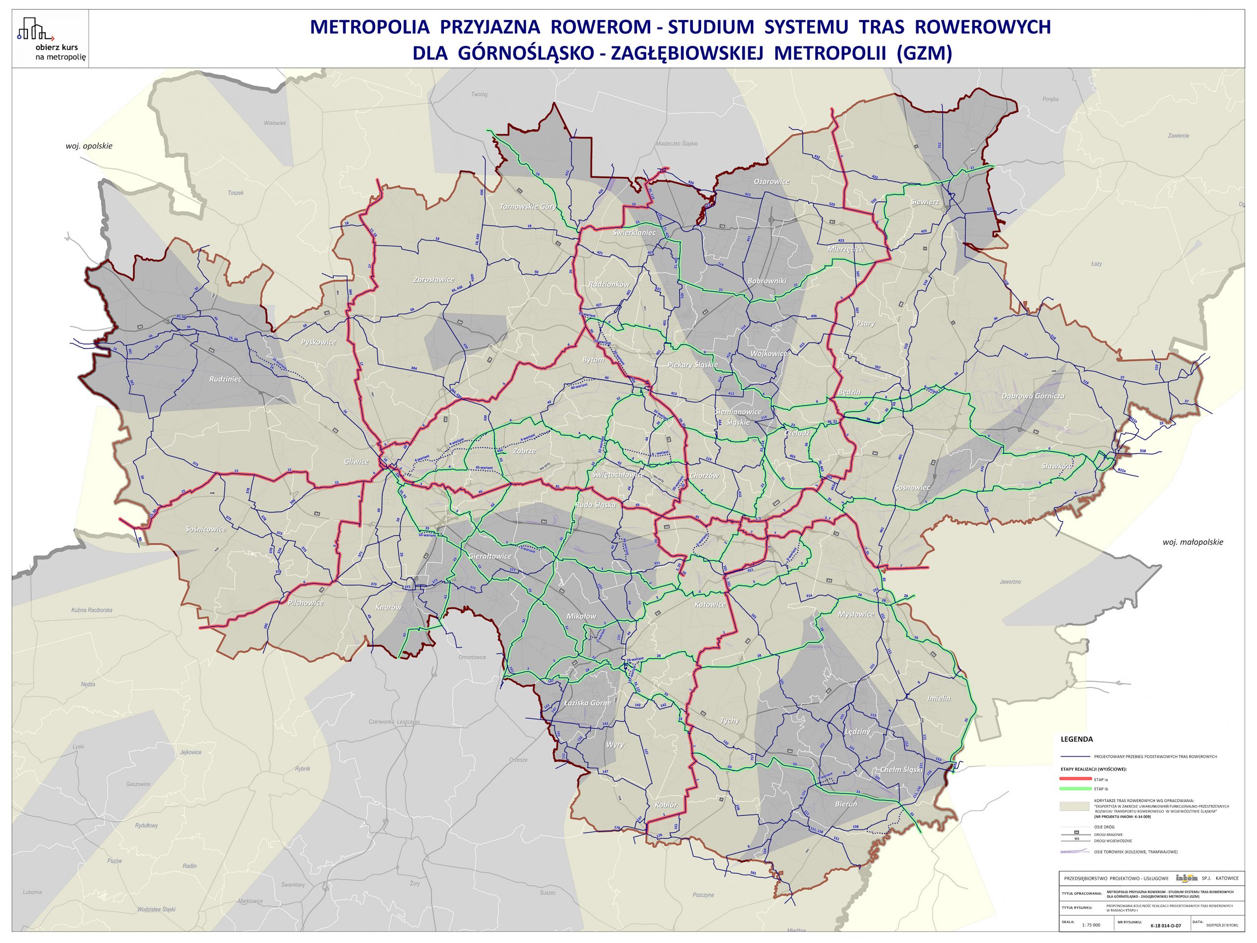
Wstępny projekt MSTR zestawiony z przebiegami z konsultacji/opiniowania oraz system wynikowy
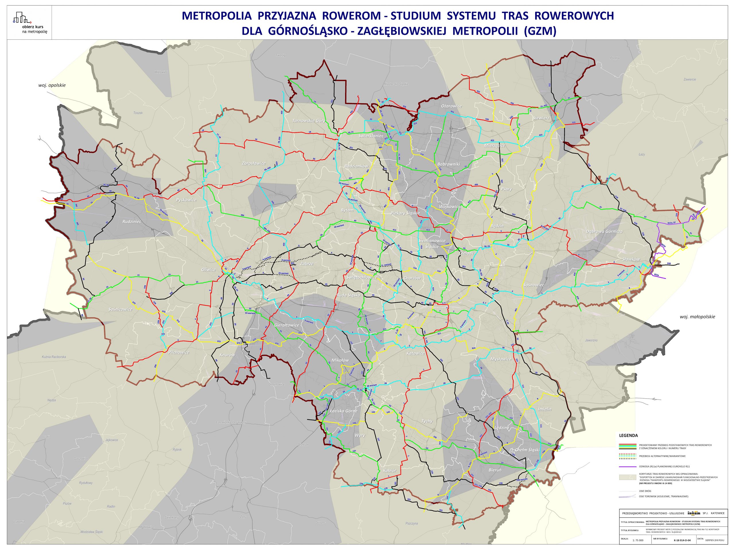
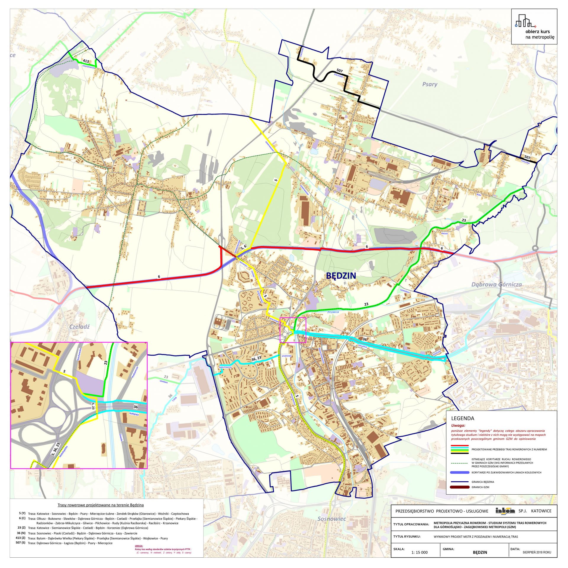
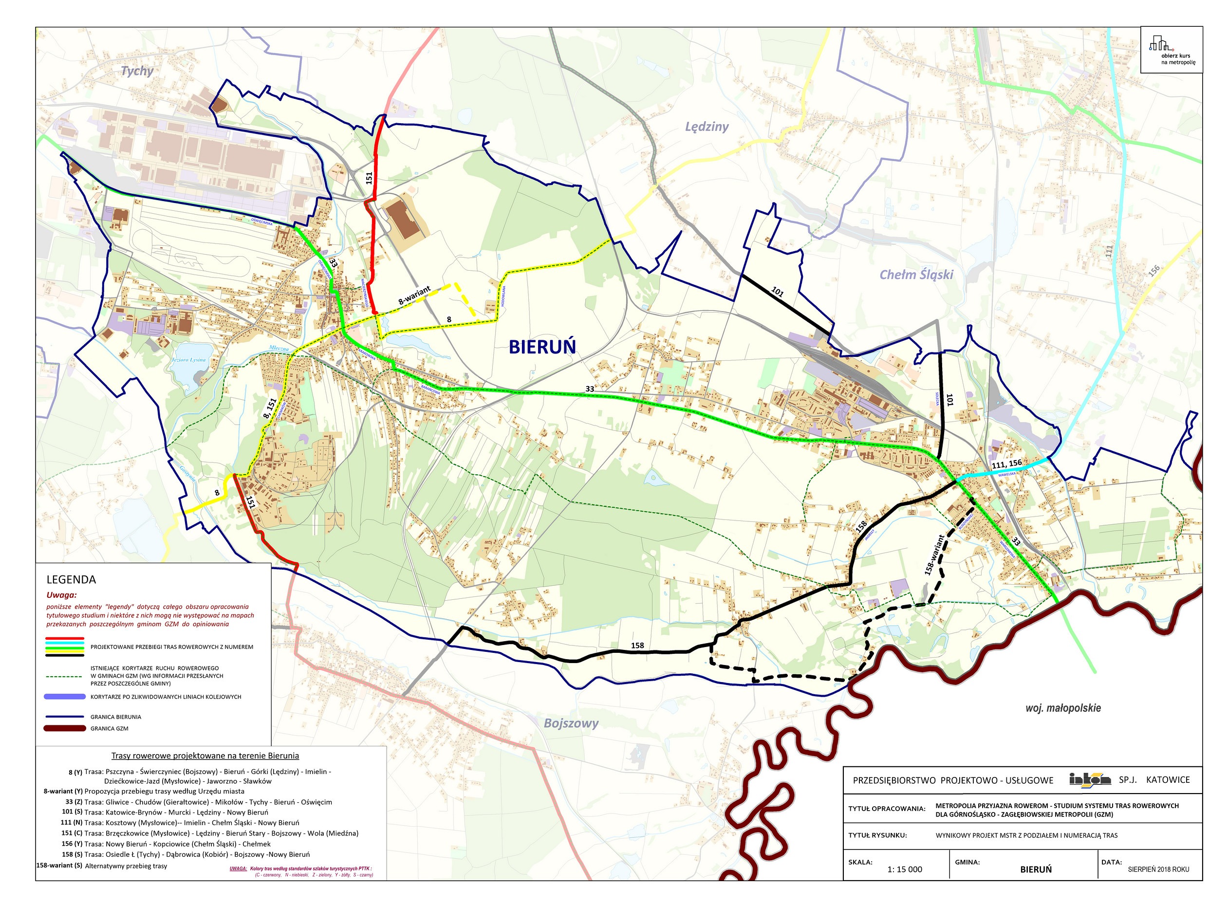
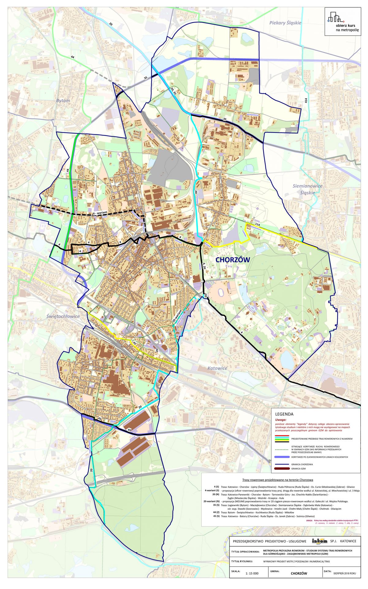
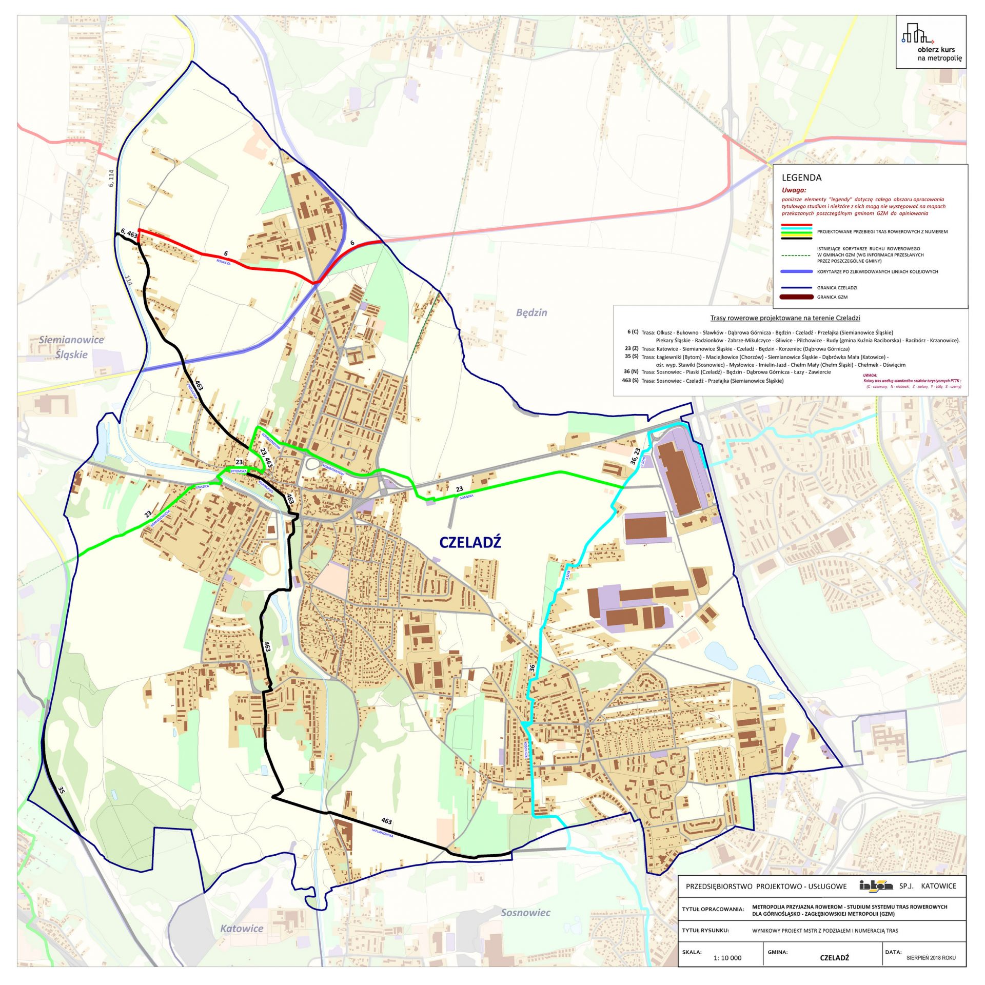
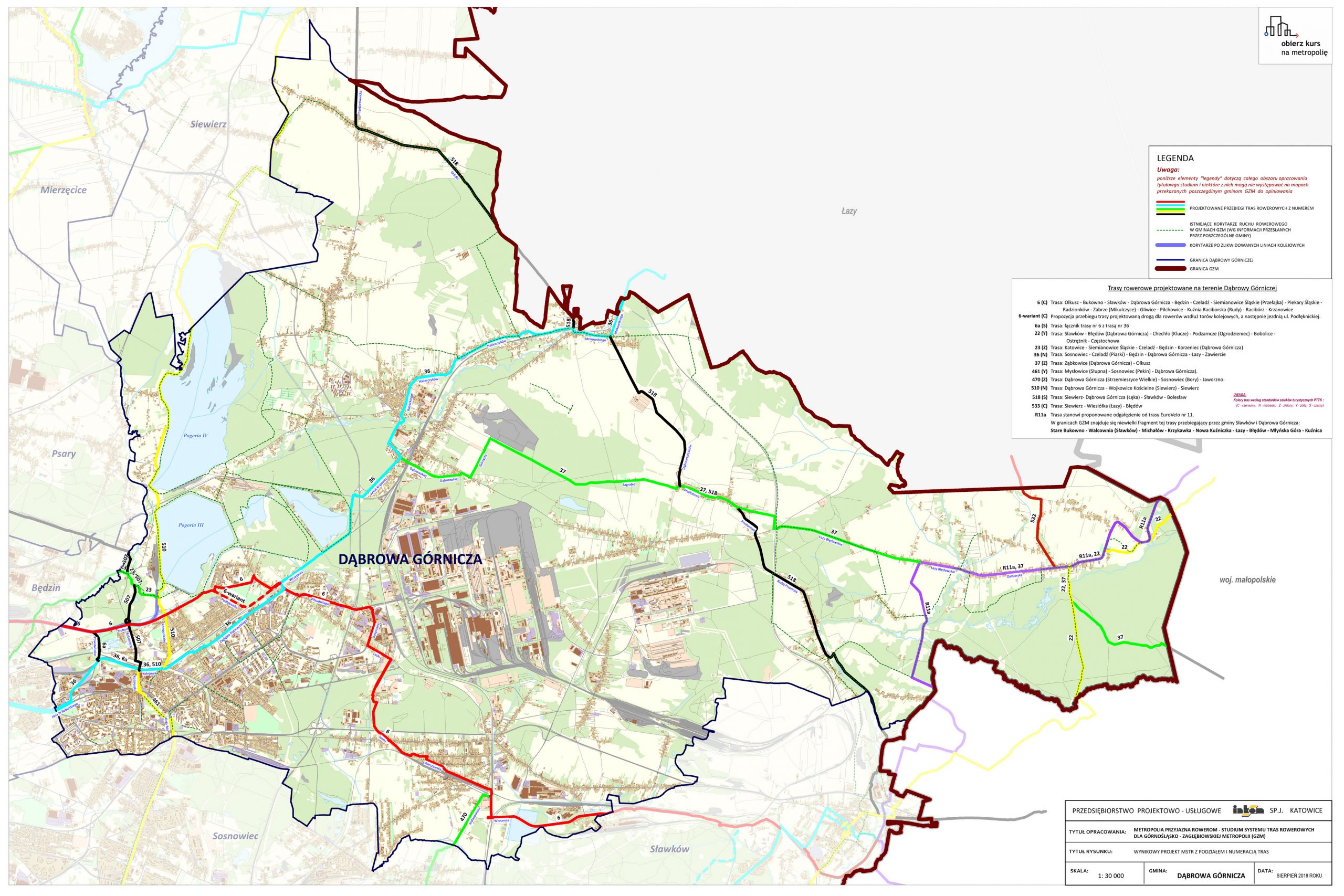
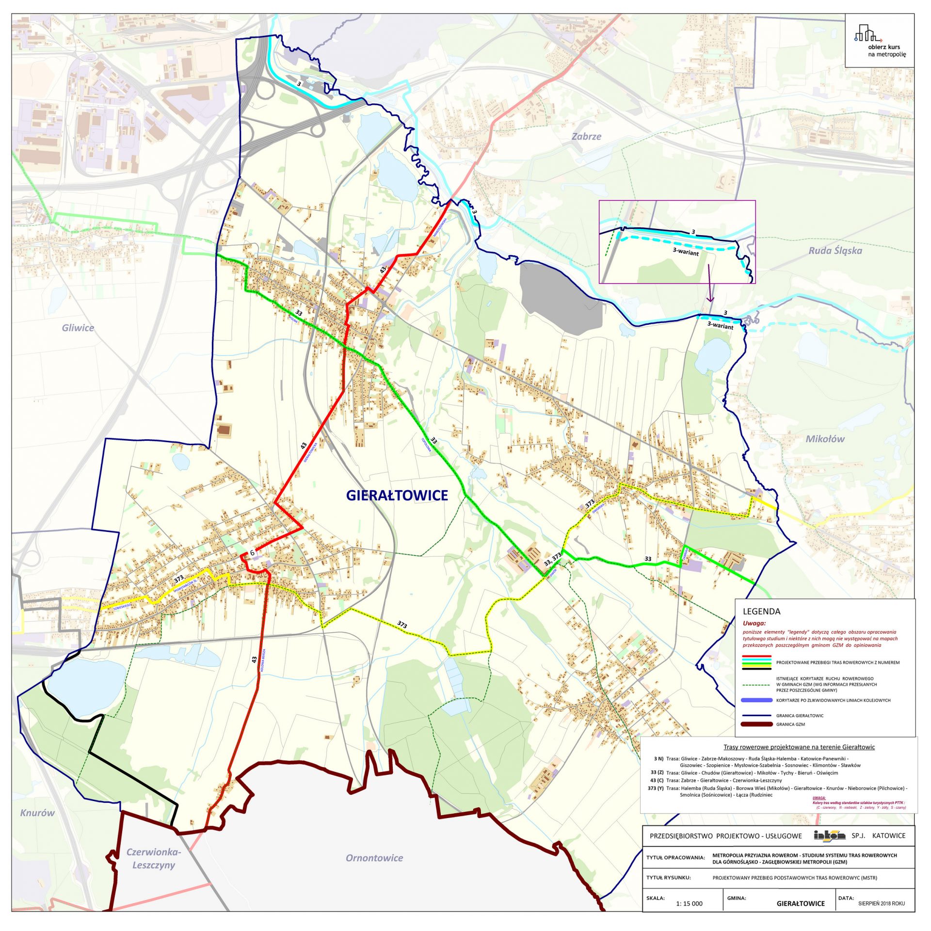
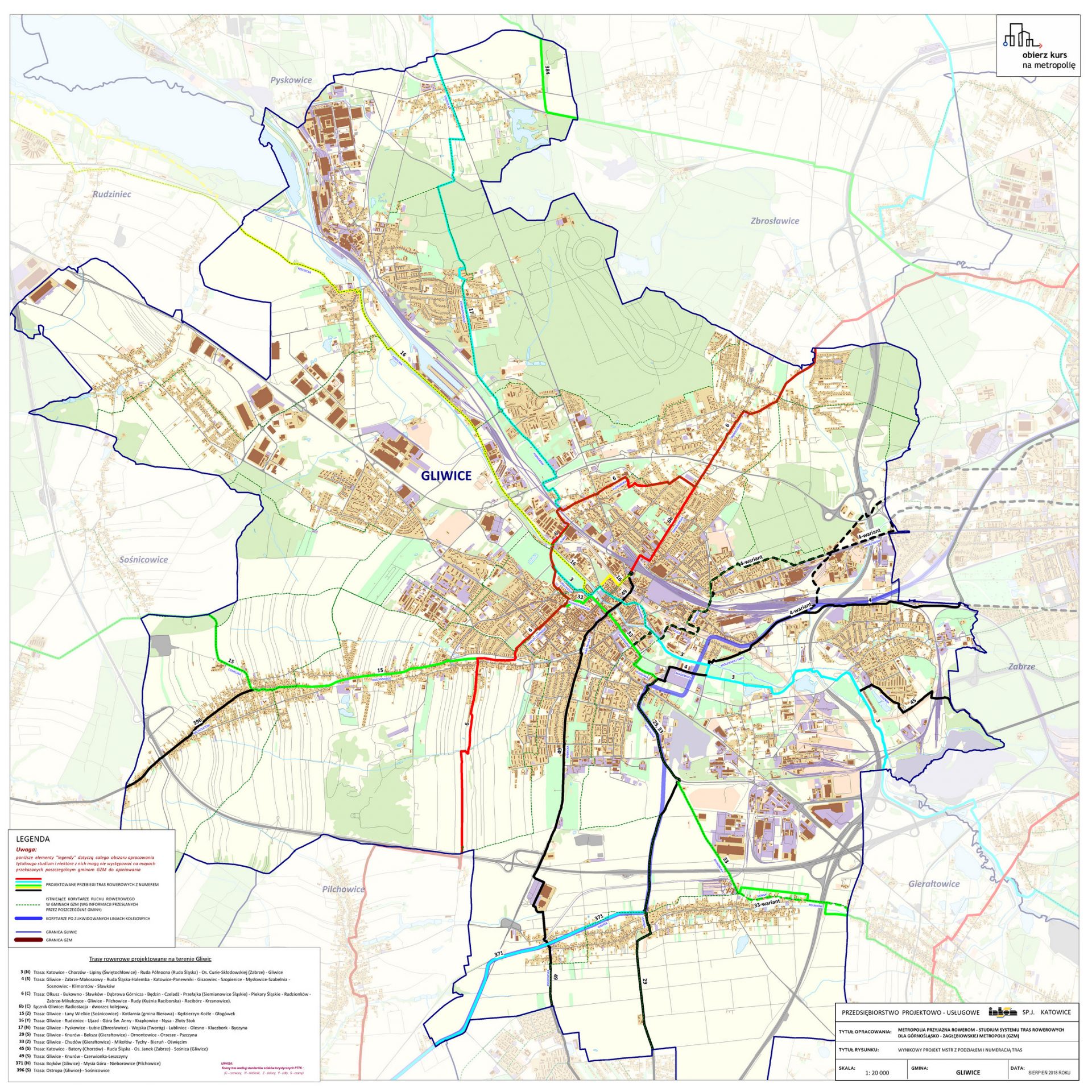
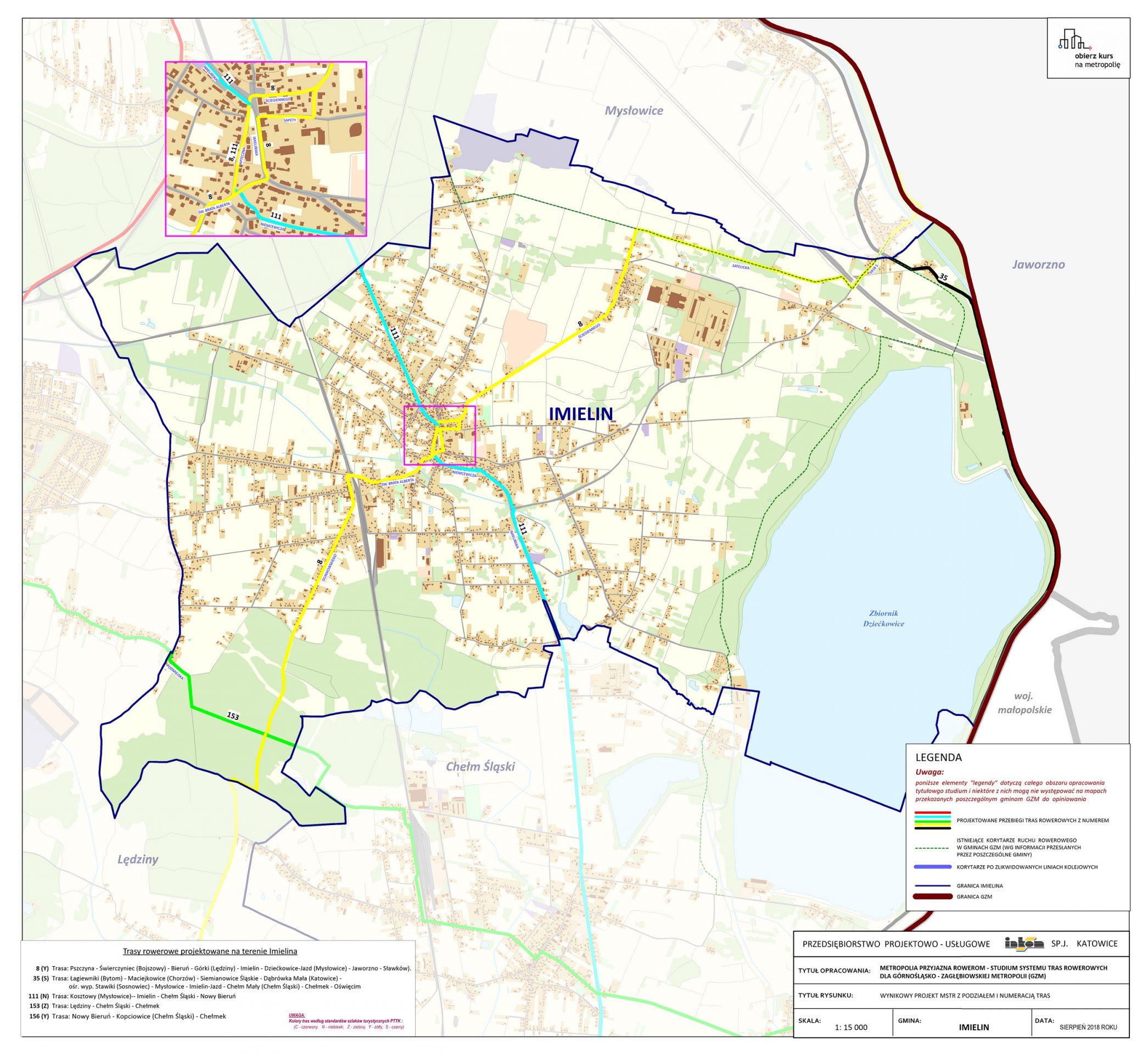
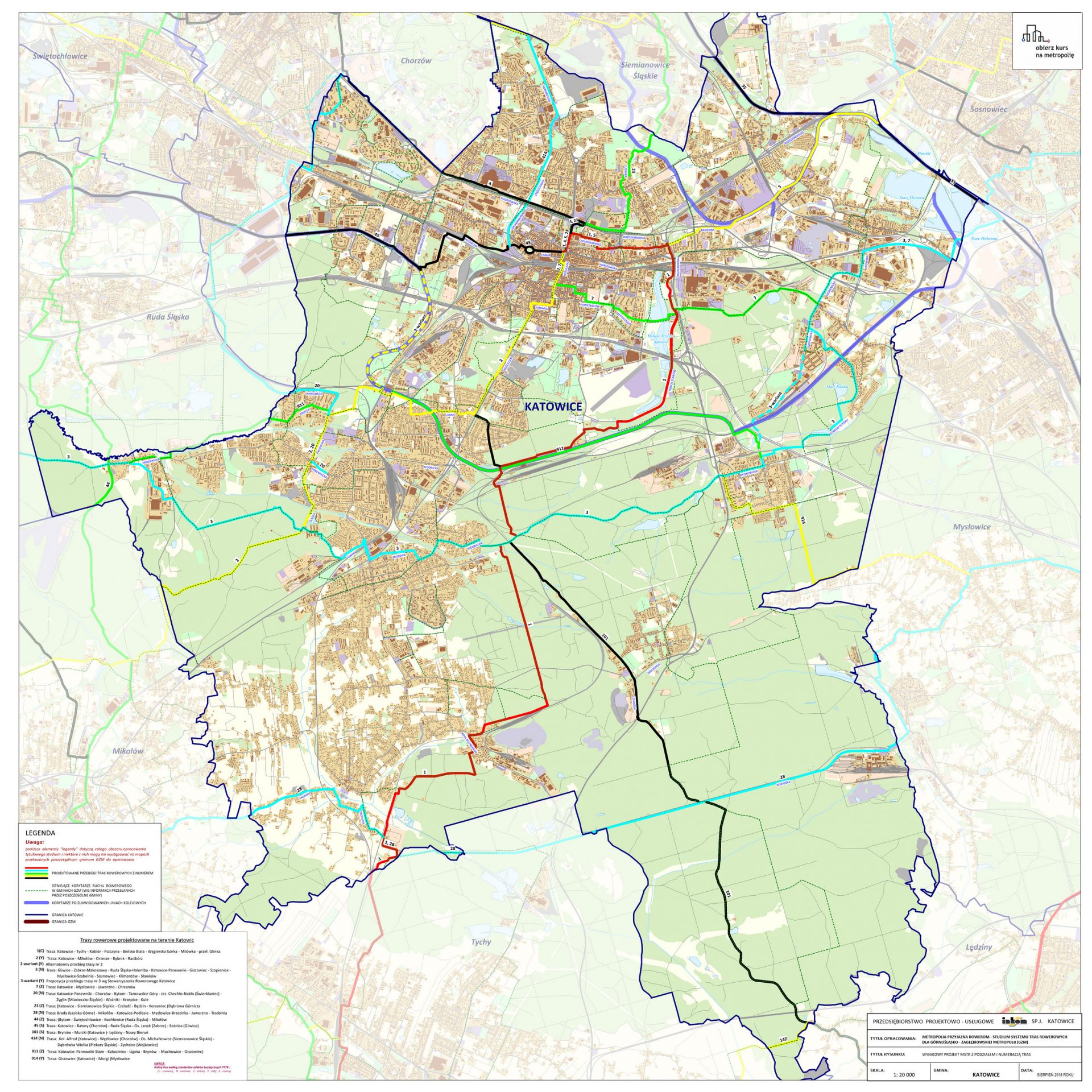
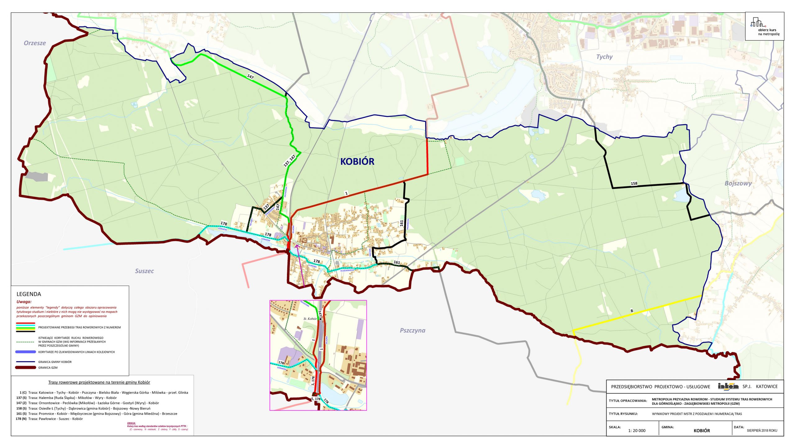
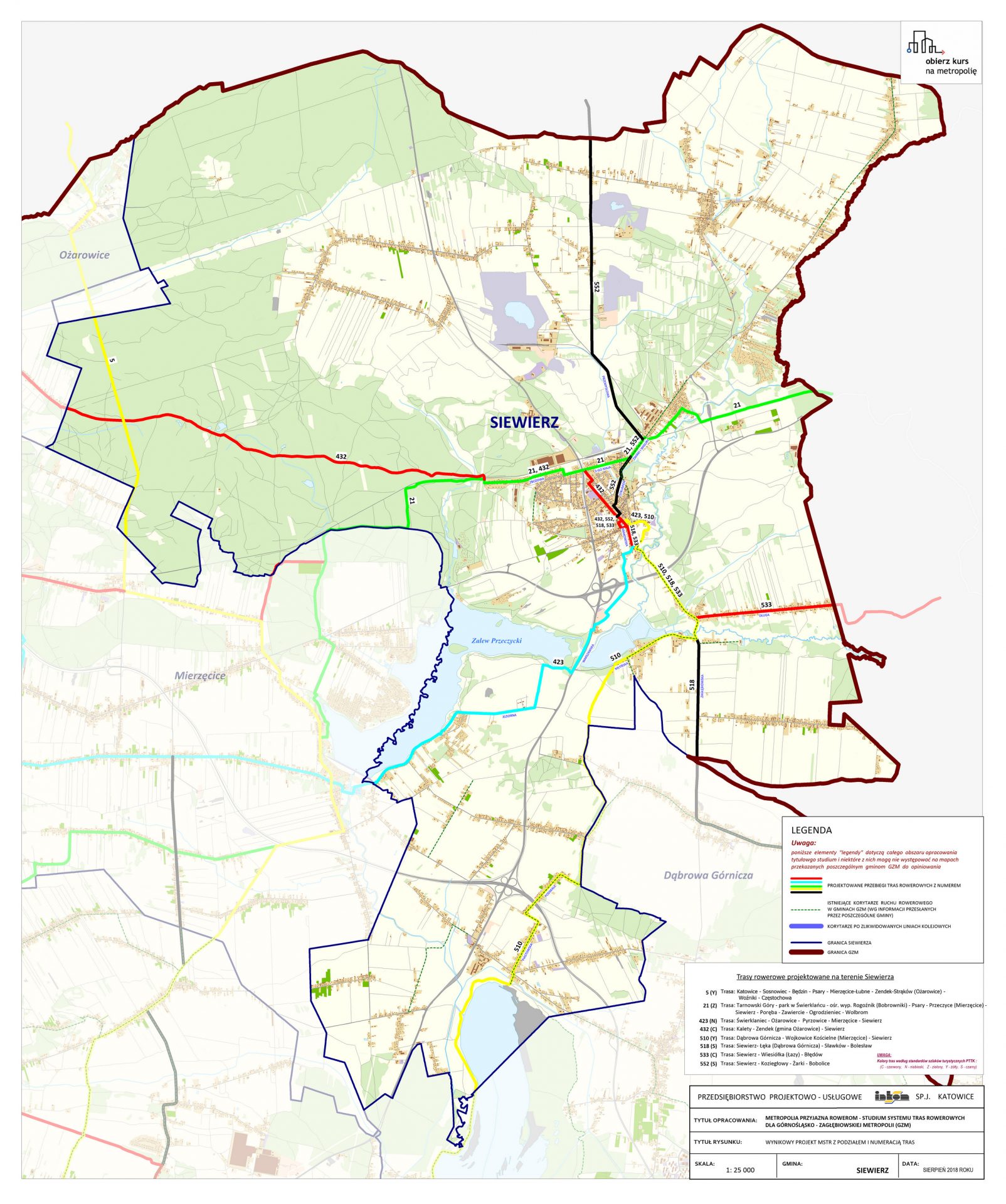
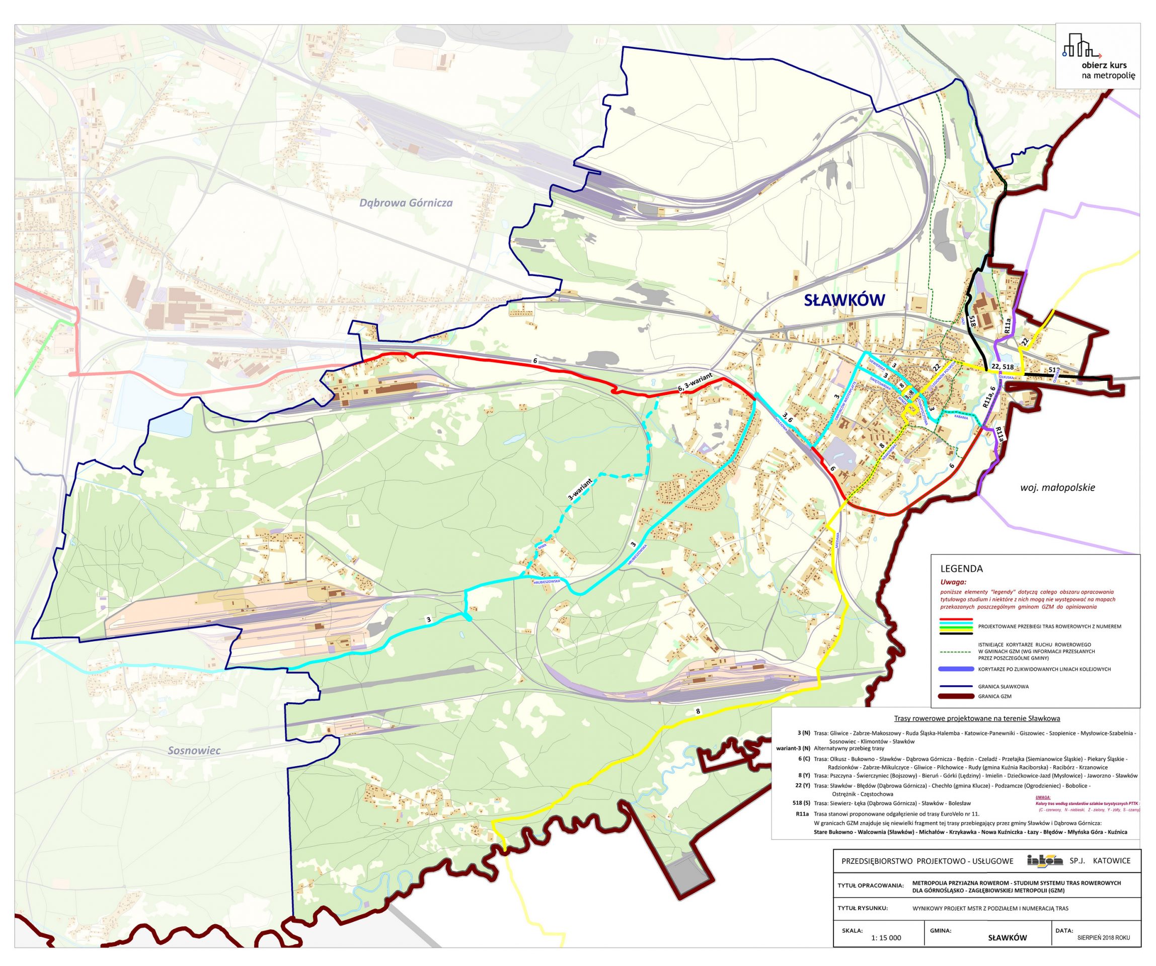
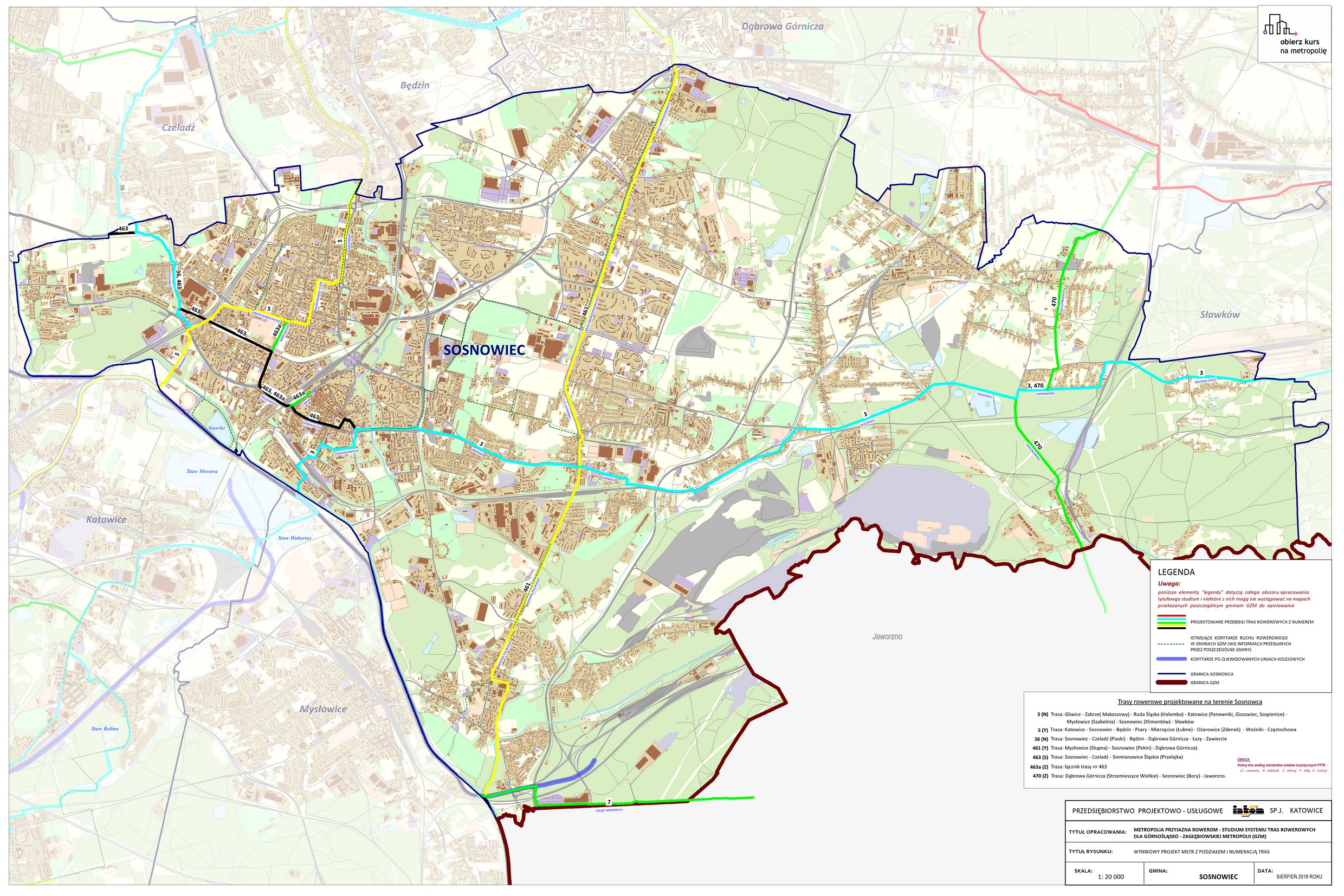
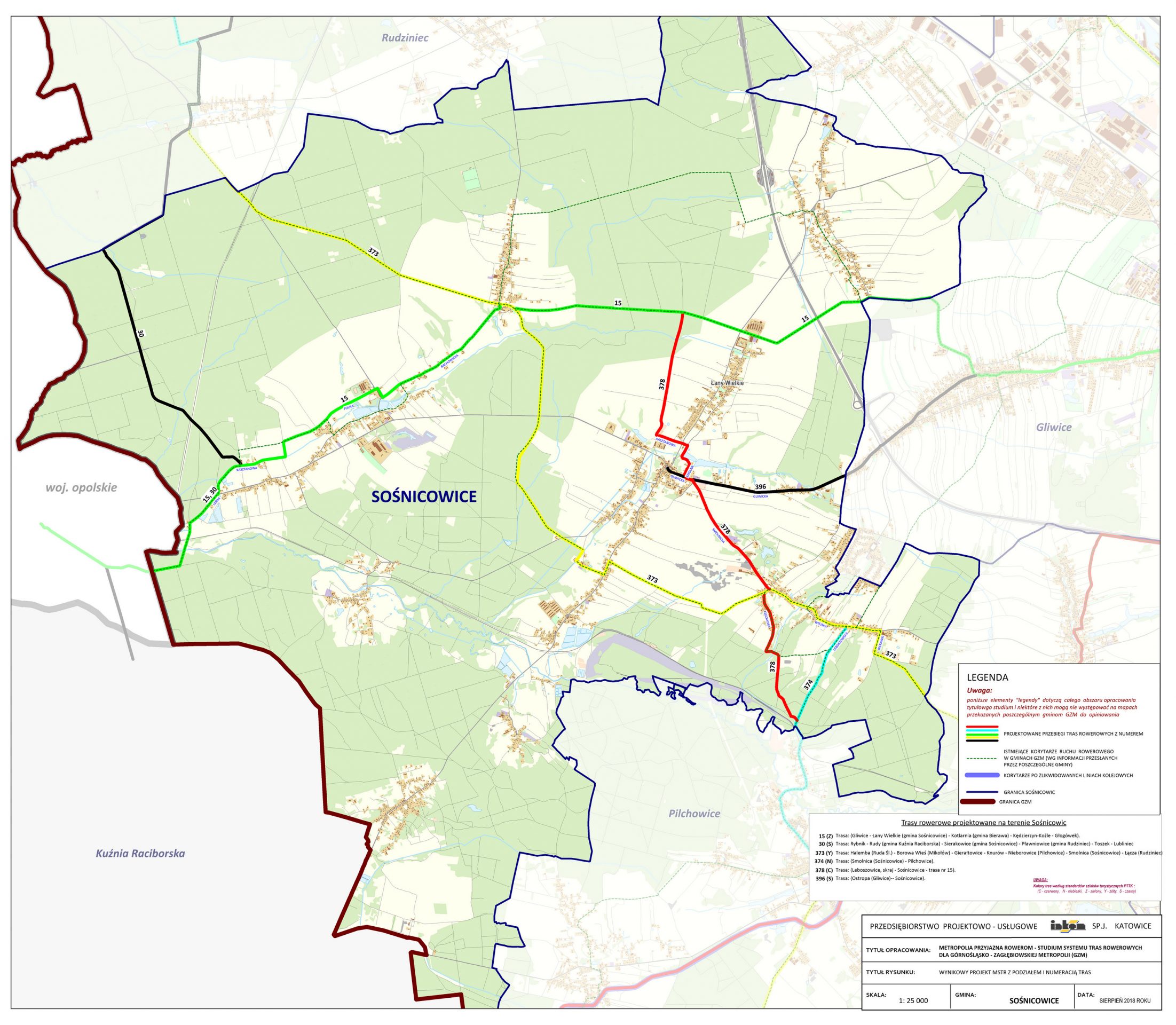
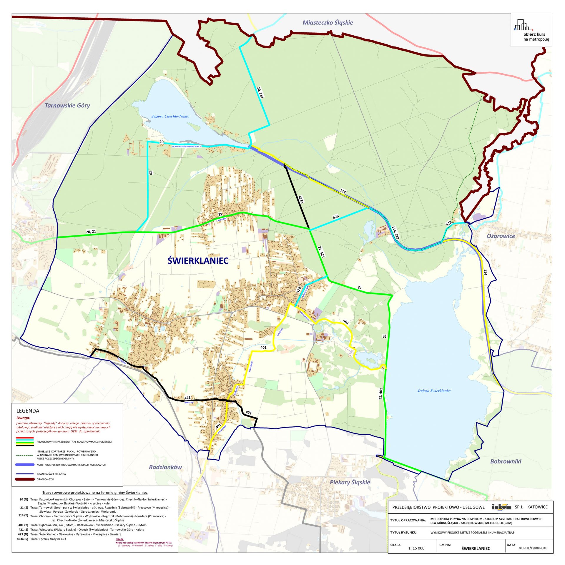
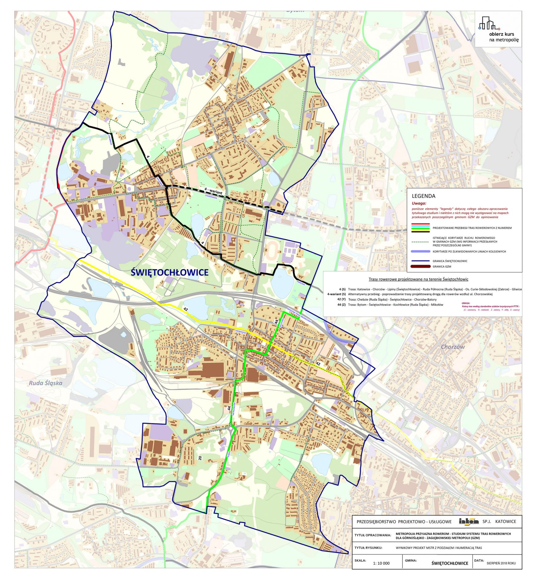
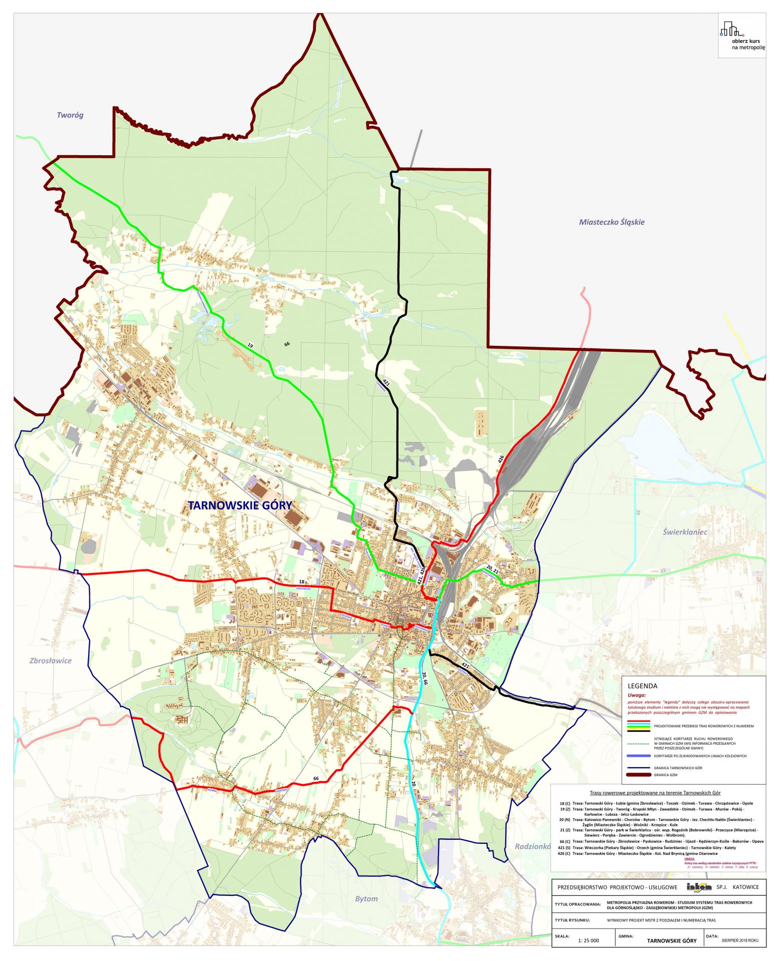
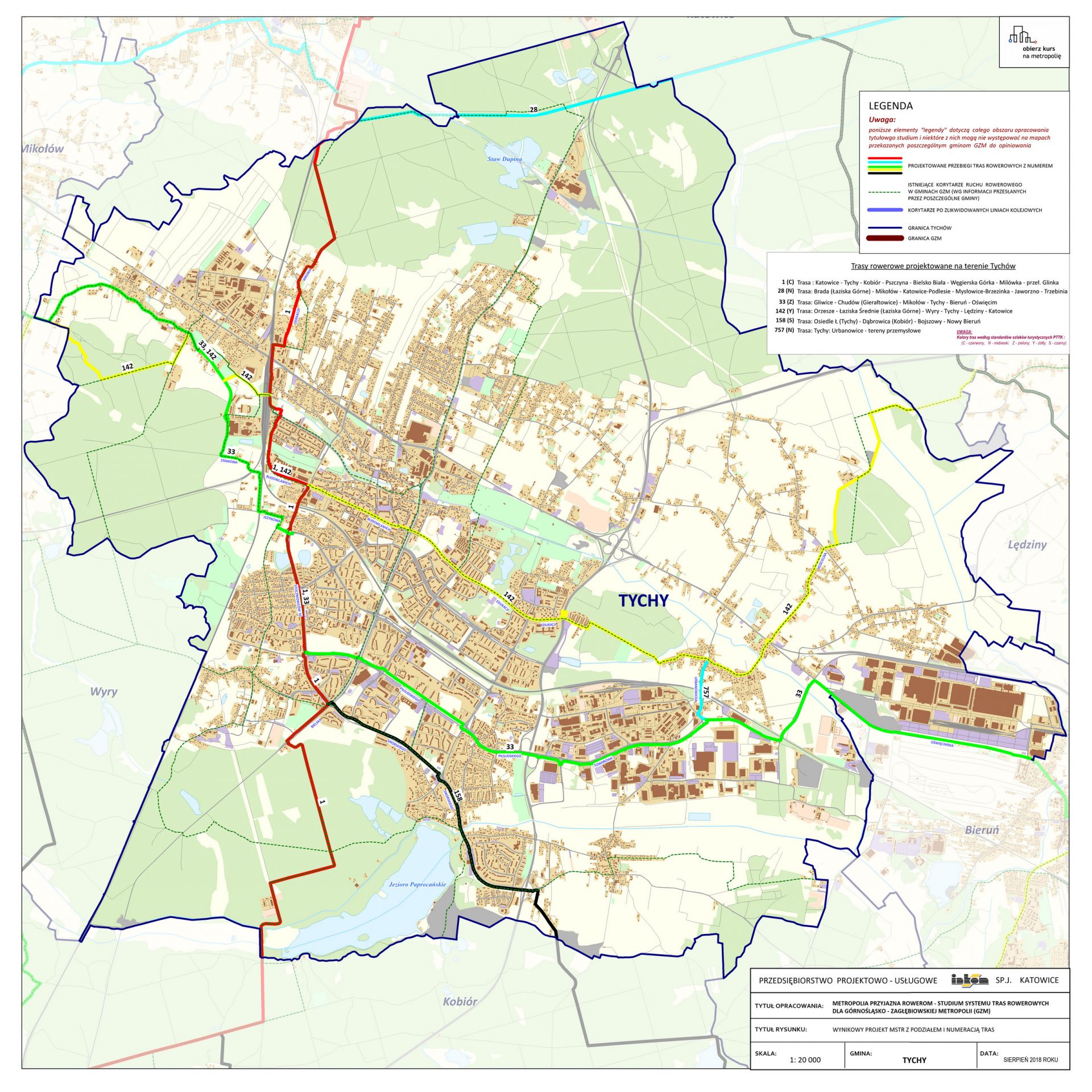
Wynikowy projekt MSTR z podziałem i numeracją tras na tle korytarzy tras rowerowych woj. śląskiego
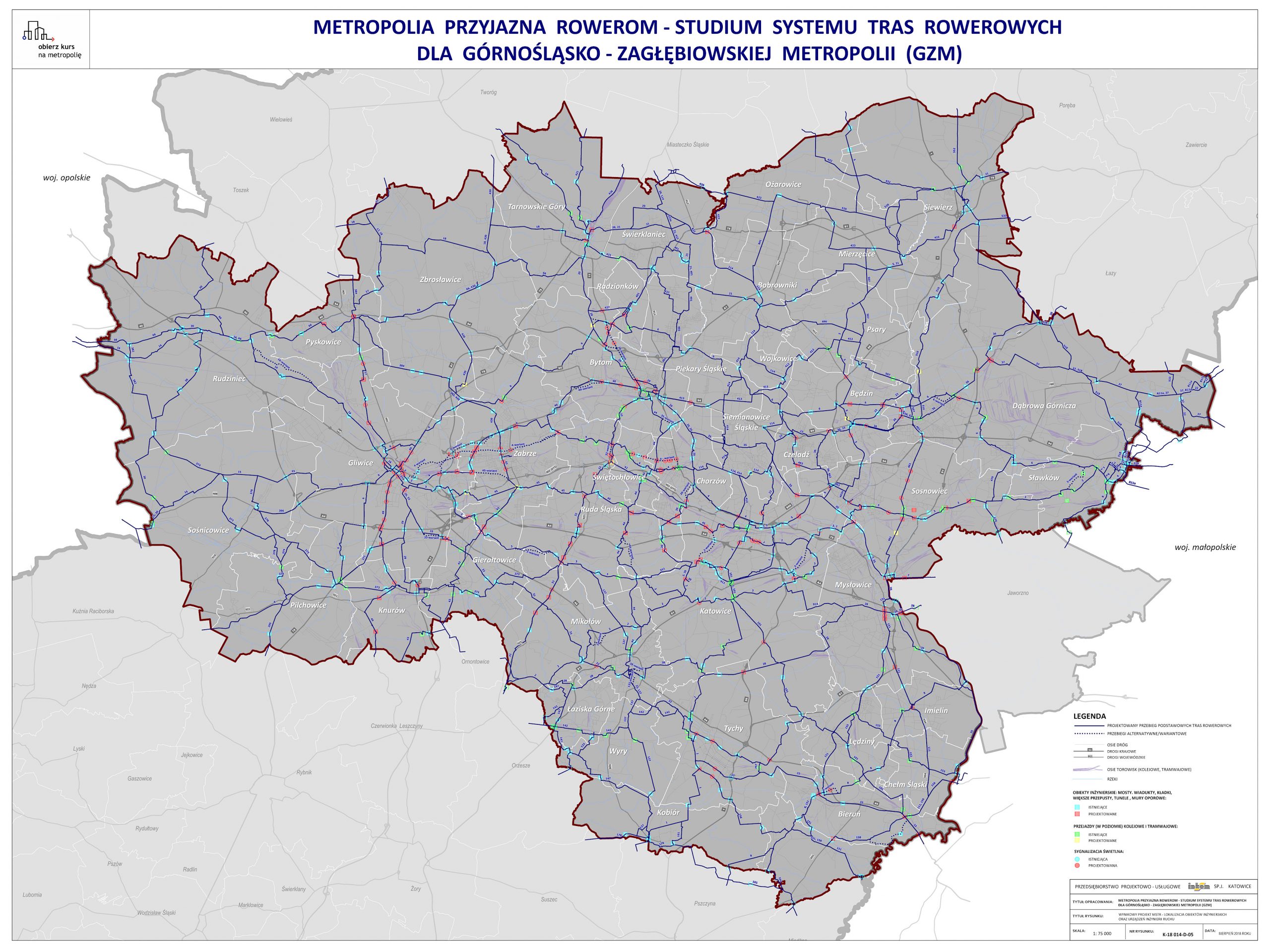
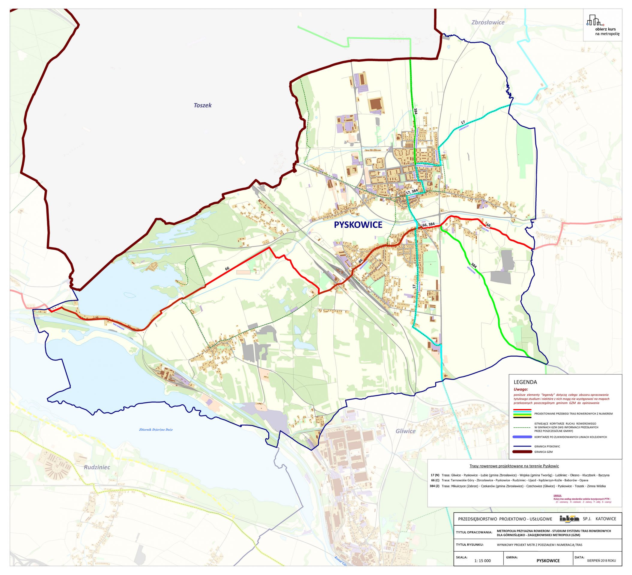
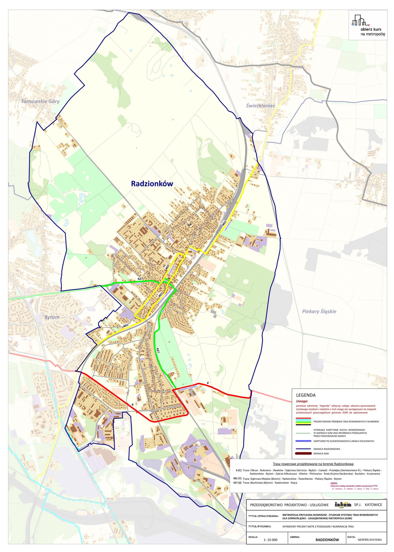
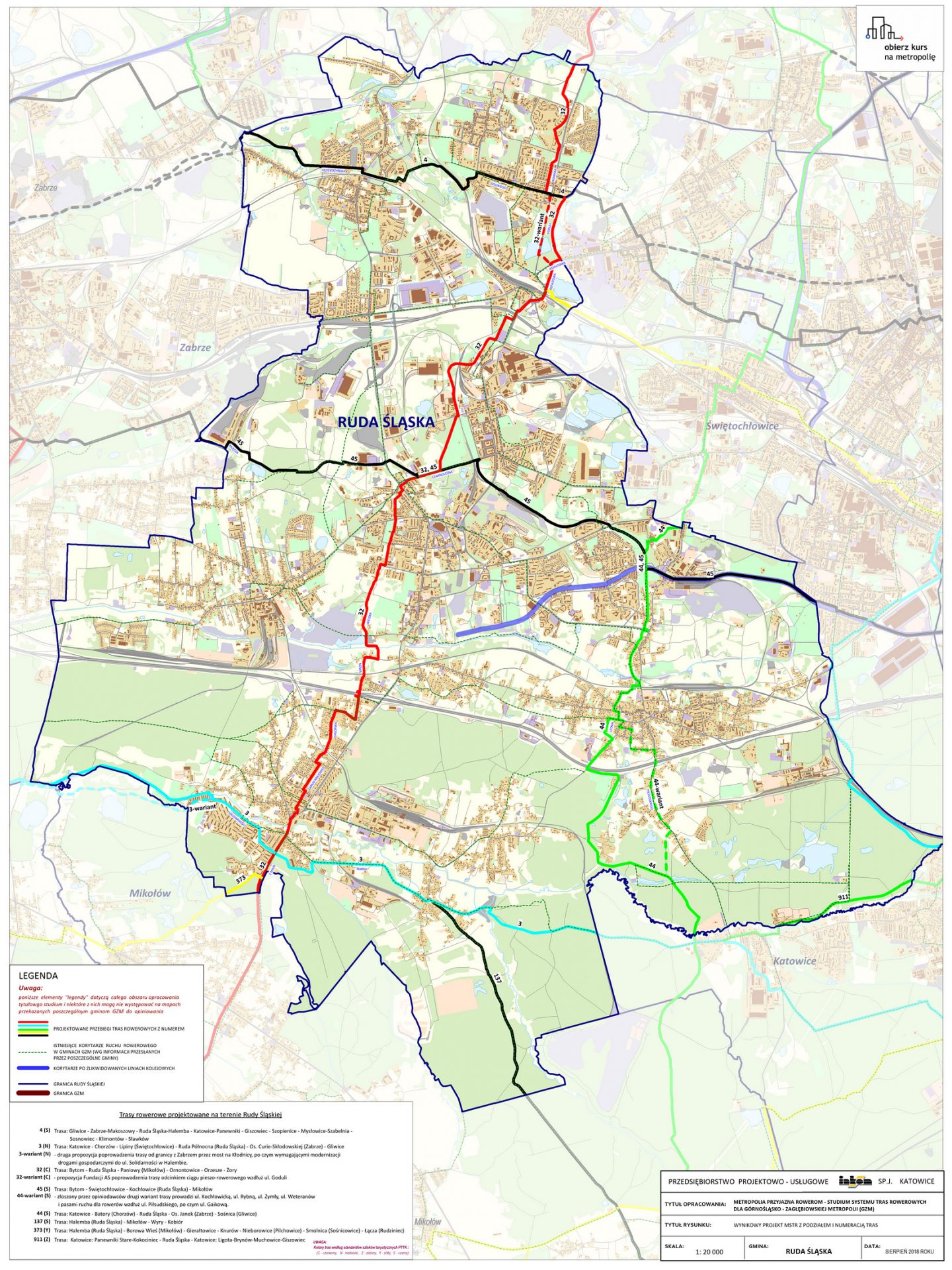
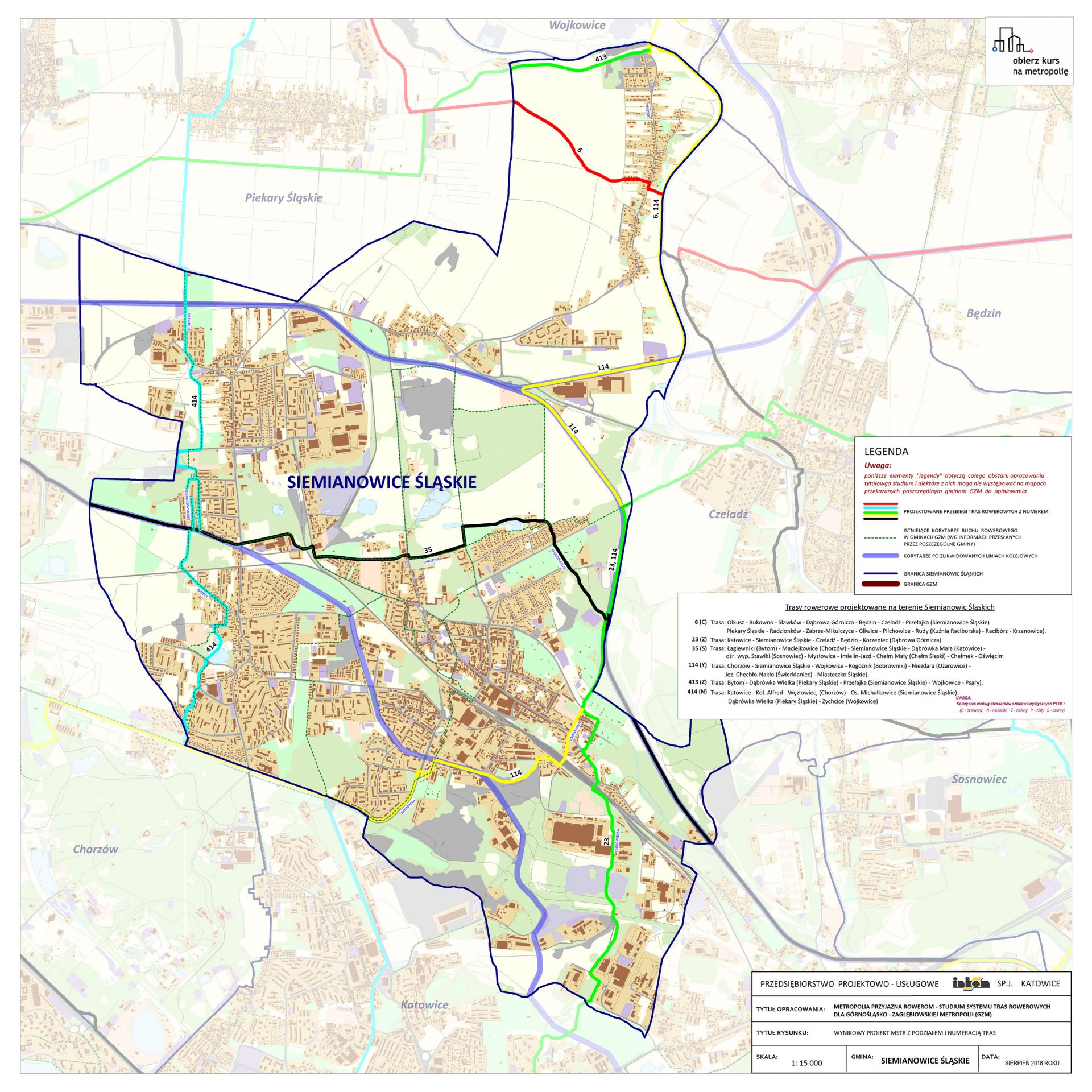
Wynikowy projekt MSTR - lokalizacja obiektów inżynierskich oraz urządzeń inżynierii ruchu
Hierarchizacja projektowanych tras rowerowych
Proponowana kolejność realizacji projektowanych tras rowerowych w ramach etapu I
Maps for GZM
Location of points of photo-inventory in the field relative to the preliminary MSRT project
Preliminary MSTR project combined with the existing bicycle infrastructure and corridors after closed railway lines
Preliminary MSTR project with routes after consultations and the output system
MSTR final project with division into and numbering of routes relative to the bicycle route corridors of the Śląskie Voivodeship
MSTR final project – location of engineering structures and traffic engineering equipment
Priority of the designed bicycle routes
Proposed sequence of execution of the designed bicycle routes during stage I
Plansze gmin
Municipality maps
© 2020 Departament Strategii i Polityki Przestrzennej. Wszelkie prawa zastrzeżone.
Urząd Metropolitalny Górnośląsko-Zagłębiowskiej Metropolii
© 2020 Department of Strategy and Spatial Policy. All rights reserved.
Metropolitan Office of Metropolis GZM